
Things To Do
Gairloch Mountain Falls
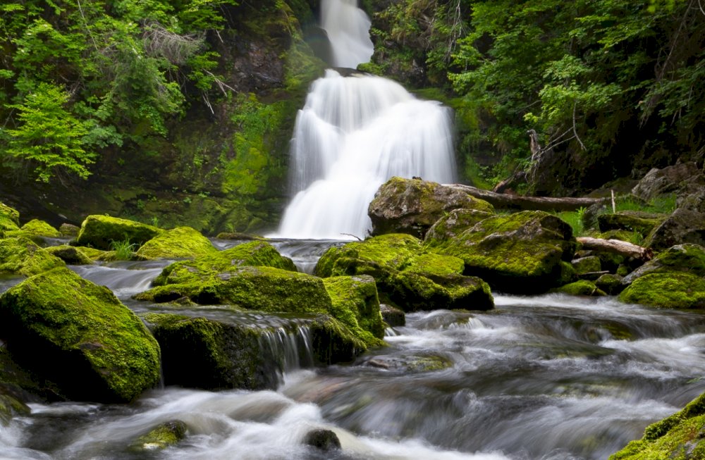
Black Brook (Gairloch Mountain Falls)
Height: 15 m
Distance (one way): 1 km
Difficulty: Moderate
Elevation: 120 m
Hiking Time: 1 hour
Cellphone Coverage: Yes (intermittent)
Finding the Trailhead: From Highway 105 west of Baddeck, turn onto Middle River West Road and then turn left onto Gairloch Mountain Road. After 1.5 km and at the Y intersection, pass over a small wooden bridge and go uphill to some flagging tape on the left side of the road located 2.1 km after crossing the bridge. Park here and follow the flagging tape into the woods in a southern direction. Road is susceptible to rain damage, only recommended with SUV type vehicles.
Trailhead: 46°07’41.7″N 60°58’38.9″W Waterfall: 46º7’20.13”N, 60º58’39.16”W
The Hike: From where you park on the logging road, the trail is marked with orange, blue and pink flagging tape all the way to the fall. It traverses a mostly maple and beech mature forest that is covered by ferns on the ground. The trail goes down slowly for the first part but then becomes very steep at the end. Ropes for the climb down are in place but be extra careful using them. Once you reach the bottom of the valley, the waterfall is only a few steps upstream.
Address: Gairloch Mountain Rd, Nyanza, Nova Scotia, Canada
Category: Things To Do
Black Brook (Gairloch Mountain Falls)
Height: 15 m
Distance (one way): 1 km
Difficulty: Moderate
Elevation: 120 m
Hiking Time: 1 hour
Cellphone Coverage: Yes (intermittent)
Finding the Trailhead: From Highway 105 west of Baddeck, turn onto Middle River West Road and then turn left onto Gairloch Mountain Road. After 1.5 km and at the Y intersection, pass over a small wooden bridge and go uphill to some flagging tape on the left side of the road located 2.1 km after crossing the bridge. Park here and follow the flagging tape into the woods in a southern direction. Road is susceptible to rain damage, only recommended with SUV type vehicles.
Trailhead: 46°07’41.7″N 60°58’38.9″W Waterfall: 46º7’20.13”N, 60º58’39.16”W
The Hike: From where you park on the logging road, the trail is marked with orange, blue and pink flagging tape all the way to the fall. It traverses a mostly maple and beech mature forest that is covered by ferns on the ground. The trail goes down slowly for the first part but then becomes very steep at the end. Ropes for the climb down are in place but be extra careful using them. Once you reach the bottom of the valley, the waterfall is only a few steps upstream.